IT
IT  DE
DE  FR
FR  FU
FU 
Traces. Ancient landscape in Friuli
Landscape is a constantly evolving product, a dynamic entity characterised by the interaction between natural and anthropic factors which took place over the many historical periods. Landscape is a real container for memory, both individual and especially collective, creating an unconscious and irrational relation with the origins of mankind. So, within a geography of memory, the tumuli, castellieri and curtains’ ancient archaeological structures help us look at the Friulian landscape with non-ordinary and fully aware eyes.
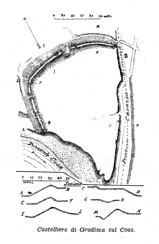
- TUMULI, CASTELLIERI AND CURTAINS
Tumuli are the monumental graves of important people belonging to the ancient bronze age communities (2500 – 1600 bc). Castellieri are bronze age villages (2500 – 950 bc) protected by tall and solid fortifications made of earth or stone, and enclosed by ditches. Curtains were the defensive system of a medieval community.
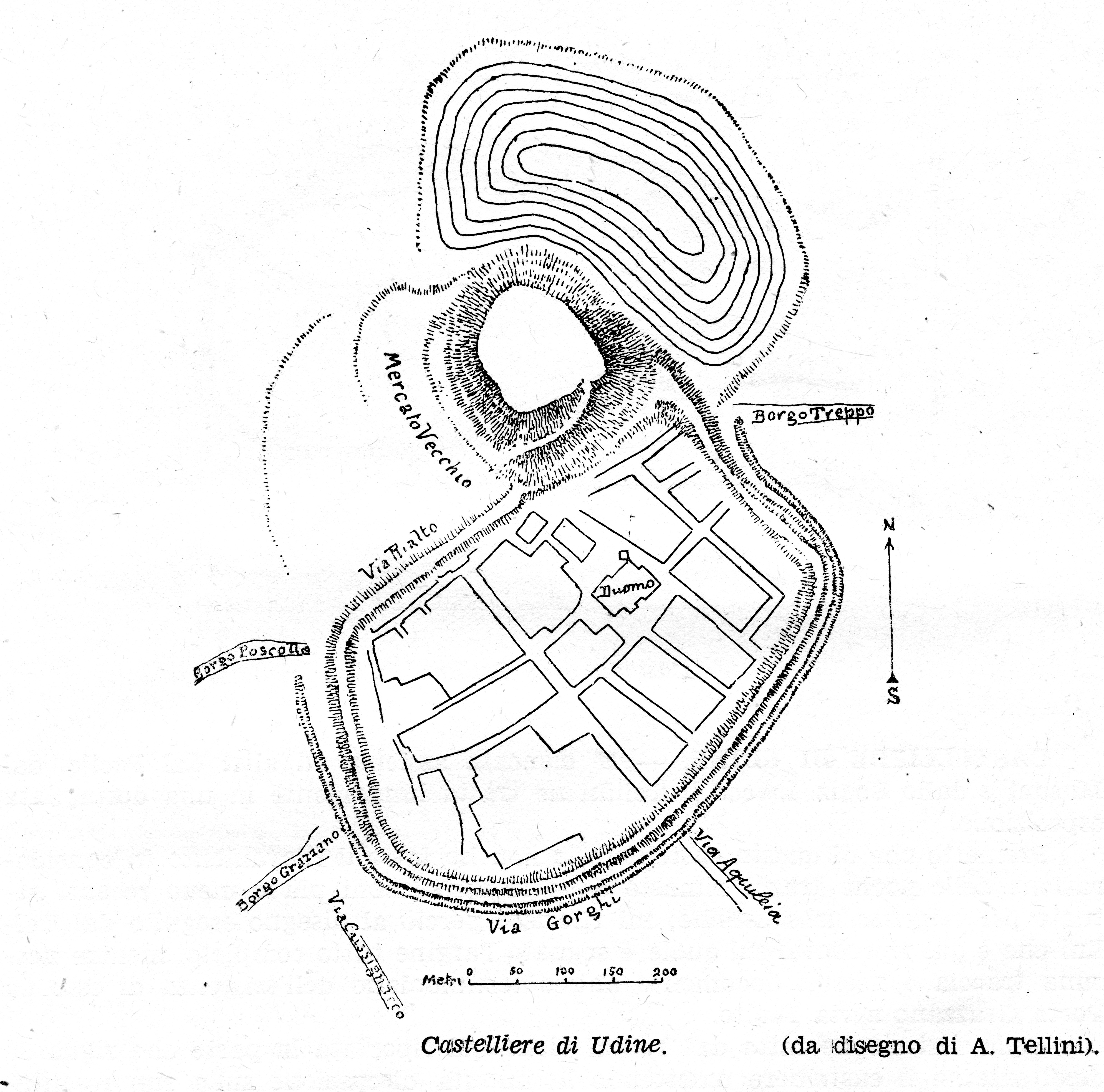
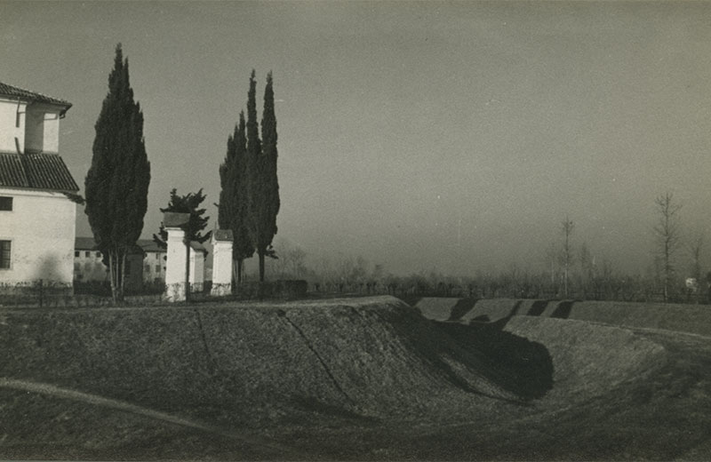
- THE CASTELLIERE OF UDINE
- ACHILLE TELLINI
Udine 1866–1938
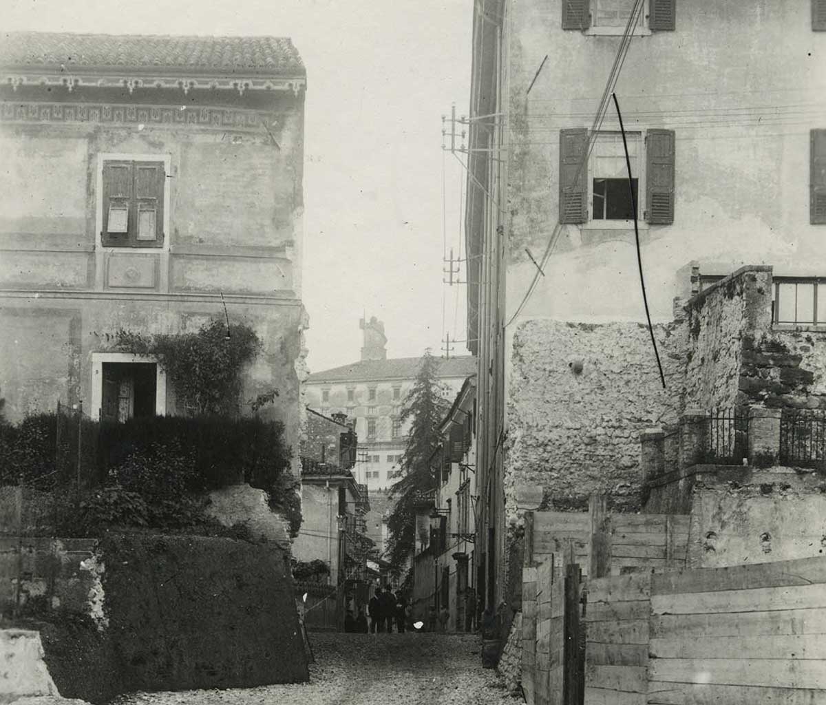
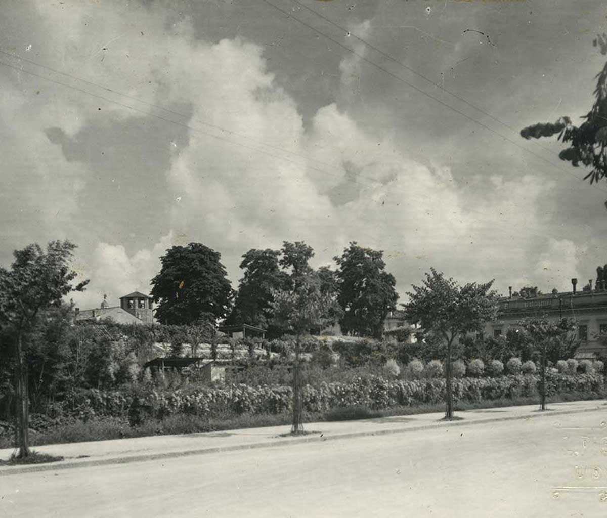
Photo from the first half of the 20th century of the area of the hypothesized embankment between Porta Manin and Ospedale Vecchio.
- WHAT WE KNOW SO FAR...
Many are the archaeological monitoring interventions carried out by the local Superintendency in the city centre. They led to the discovery of the archaeological layers attributable to the Castelliere of Udine under the significant Medieval and Renaissance levels. The first excavations, carried out in 1996 on top of the Castle’s hill, brought to light a waste pit (a typical structure inside the castellieri) containing over 8,000 pottery sherds attributable to the Final Bronze Age (11th c. BC). In the church of San Francesco waste pits and pottery cooking pits have been found. Recently, in Palazzo Mantica, the premises of the Società Filologica Friulana, researchers found part of the agger, the rampart defending the inhabited area. Archaeological structures and finds have been discovered also in Via Mercatovecchio, near the Cassa di Risparmio di Udine e Pordenone bank premises, in Piazza Venerio and during the restoration works of Casa Cavazzini. The analyses of those data carried out by the University of Udine, which are currently still underway, acknowledged the frequentation of the area from the Recent Bronze Age up to the full Iron Age (14th – 5th c. BC).
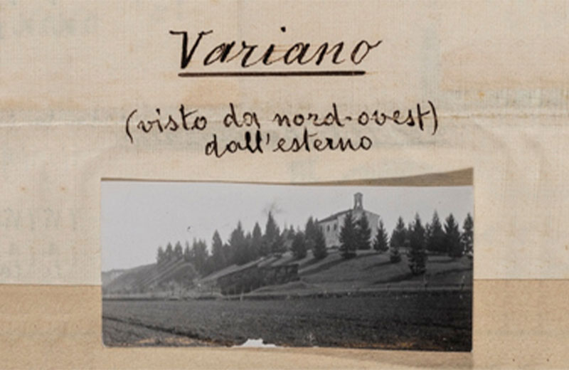
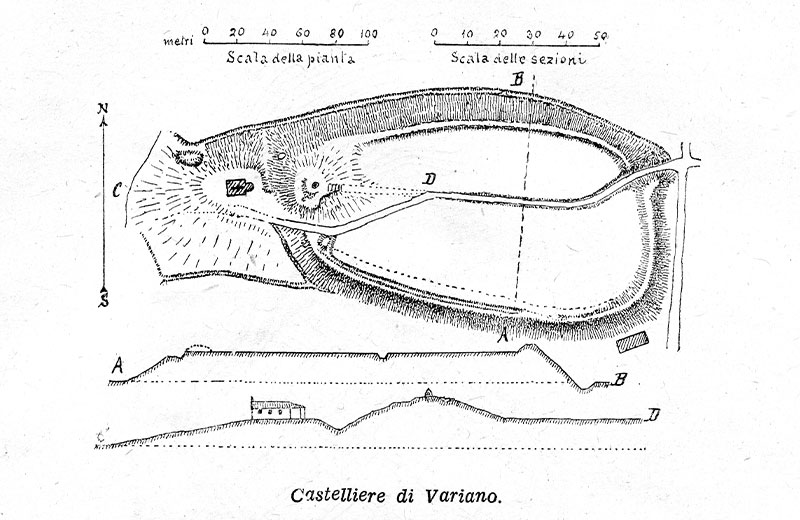
- TUMULI AND CASTELLIERI
Already in the 18th century, scholars of various interests identified traces of ancient frequentation in some recurring morphological aspects of the territory. But only at the end of the 19th century and the beginning of the 20th century, Achille Tellini and Giovanni Battista De Gasperi first, and Lodovico Quarina later, associated tumuli and castellieri, significant elements of the Friulian landscape, with what had already been observed in the neighbouring regions, and they attributed them to the prehistoric man’s modifying action.
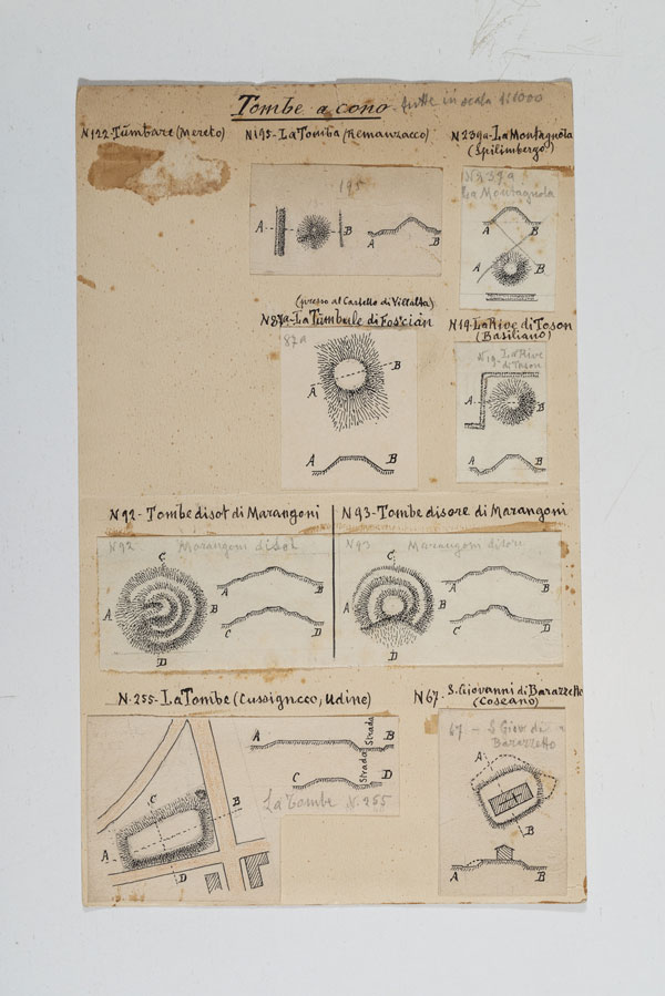
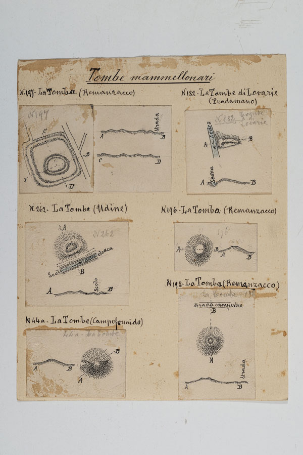
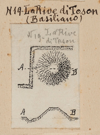
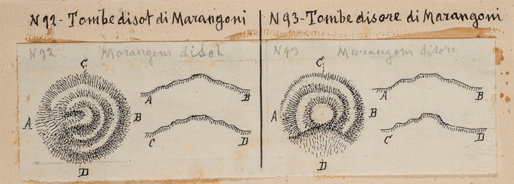
- LODOVICO QUARINA
He was a land surveyor, and worked at the land registry office. He studied speleology, geology, toponymy, history and archaeology. He worked with the Accademia di Udine, the Società Alpina Friulana and the Società Filologica Friulana. In 1943 he published the research paper “Castellieri e tombe a tumulo in Provincia di Udine” on the Società Filologica Friulana’s periodical.
- WHAT WE KNOW SO FAR...
Reliefs of some tumulus tombs. Manuscript by Lodovico Quarina (Civic Library “V. Joppi”, Manuscripts and Rare Items Section, f.p. 2605).
- WHAT WE KNOW SO FAR...
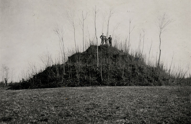
Tumuli are monumental graves made to highlight the burials of important people belonging to the Ancient Bronze Age communities (2500 – 1600 BC). The excavation works carried out by the University of Udine and the local Superintendency, especially at Mereto di Tomba and the district of Sant’Osvaldo in Udine, uncovered the presence of a male individual, his body lying in a pit or a wooden coffin. The construction of a monumental grave created a connection between the communities and the places where their ancestors were buried. That tradition ended in the Middle Bronze Age (1700/1600–1350 BC), when the landscape was characterised by other well-established evidences: the castellieri.
- THE MEDIEVAL CURTAINS
Originally, curtains were the defensive system of a community, separated from the castle, and spontaneously created by the community, thus providing itself with some self regulation. Within the curtains, the vicinie, community meetings, were frequently held to manage collective properties. The origin of those fortifications is uncertain, and it is indicatively attributed to the Middle Ages; documents show that they were widespread between the 14th and 15th centuries.
- PIETRO SOMEDA DE MARCO
Mereto di Tomba 1891–1970
He graduated in Laws and worked as a notary in Udine and Mereto di Tomba, where he also became potestà. He was a member of the Accademia di Udine, the Deputazione di Storia Patria, the Ateneo Veneto and other institutions; poet and essayist, he devoted his attention to archaeology, especially in his own town, by precisely recording the data concerning the finds that were constantly uncovered in the fields and later donated to the Civic Museums of Udine, where Pietro’s twin, Carlo, worked as the director from 1932 to 1958.
- WHAT WE KNOW SO FAR...
- THE PRESENT LANDSCAPE
The emerging morphological features attributable to Prehistory and the Middle Ages, inform the historic collective memory, leaving an identity mark on the Friulian territory. Their preservation and conservation allow to promote areas almost always unknown to the general public, and support the slow tourism dedicated to knowledge.